 |
|

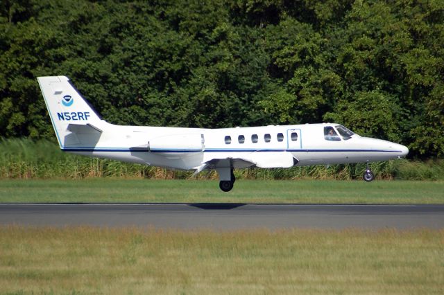
Cessna Citation II (NOAA52)
The Cessna Citation (CE-550) is a versatile twin-engine jet aircraft modified for acquiring remote sensing imagery. The aircraft is equipped with two equal sized camera ports which can support a wide variety of remote sensing configurations including large format aerial photography as well as data collection for digital cameras, hyperspectral, multispectral, and LIDAR systems. Standard configuration includes space for two pilots, two equipment operators, and a scientific equipment rack. The aircraft can accommodate additional passengers depending on the amount of scientific equipment. The aircraft's unique side-by-side sensor port modification allows two different sensors to collect data simultaneously. The sensor ports have glass optical flats that allow the cabin to remain pressurized. Additionally, two high-precision GPS antennas provide signals to user receivers. The Citation primarily supports the Remote Sensing Division of the National Geodetic Survey, collecting remote sensing data in support of coastal mapping and remote sensing research. Imagery acquired onboard the Citation is used for updating the shoreline and shore features on NOAA's nautical charts. The Citation also serves as an emergency responder during hurricane season by collecting digital photography of damaged areas caused by hurricane landfall.
Comments
|
سجل النشاط
هل تريد البحث عن التاريخ الكامل لـ NOAA52 والذي يعود إلى عام 1998؟ اشتر الآن، واحصل عليه في غضون ساعة واحدة.
|
| التاريخ | الطائرة | نقطة الانطلاق | الوجهة | مغادرة | وصول | المدة |
|---|---|---|---|---|---|---|
| No Recent History Data | ||||||
| يُتاح للمستخدمين الرئيسيين (التسجيل كمستخدم رئيسي يتم بشكل مجاني وسهل!) عرض 3 months من المحفوظات. انضم إلينا | ||||||
Please log in or register to post a comment.