الكل
 |
|

Comments
Nice shot.
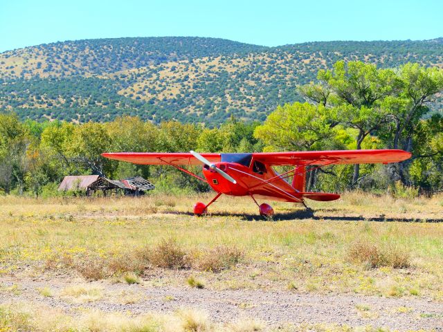
Thought Z66 looked like west Texas, so looked it up on airnav. So, it's in east Arizona on the border of New Mexico.
2800 foot gravel strip, 4,800 altitude, owned by the forest service.
For those who want something secluded, airnav says:
- PRIMTIVE, NARROW AIRSTRIP, NO SERVICES, NO CELLULAR, USE AT PILOTS OWN RISK, NO TRAINING OR TOUCH AND GOES.
- OBSTRUCTIONS, TREES & STRUCTURES SOUTH OF RWY, RISING TERRAIN NORTH OF RWY.
- CALM WIND RWY 17, CULVERT NARROWS AIRSTRIP AT APPROX. 600' SOUTH OF RWY 17 THLD.
- PARKING WEST SIDE OF RWY NEAR RWY 35 THLD, NO TIE DOWNS.
- FIRE RING AND COOKING GRATE NEAR WIND SOCK, CHECK USFS FIRE RESTRICTIONS.
|
سجل النشاط
هل تريد البحث عن التاريخ الكامل لـ N77315 والذي يعود إلى عام 1998؟ اشتر الآن، واحصل عليه في غضون ساعة واحدة.
|
| التاريخ | الطائرة | نقطة الانطلاق | الوجهة | مغادرة | وصول | المدة |
|---|---|---|---|---|---|---|
| No Recent History Data | ||||||
| يُتاح للمستخدمين الرئيسيين (التسجيل كمستخدم رئيسي يتم بشكل مجاني وسهل!) عرض 3 months من المحفوظات. انضم إلينا | ||||||
Please log in or register to post a comment.